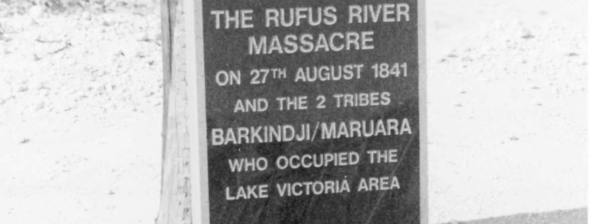
| Name: | Rufus Creek Area and Massacre Burial Site |
| Location: | Adjacent to and south of Lake Victoria |
| Use: | Massacre Site |
| Constructed: | 0 |
| Demolished: | 0 |
| Theme: | The People |
| Condition: | Burials disturbed and scattered by erosion process |
| Endorsements: | Registered item of the National Estate, NSW Parks & Wildlife Service Aboriginal Sites Register |
Statement of Heritage Significance:
Architecture/Environment:
The massacre site is in Rufus Creek, 50 metres downstream from the weir at Lake Victoria. The actual burial site is located about 100 metres due north of the massacre site in the sand dunes about 25 metres north of the fence line. The entire area covers some 700 hectares.
History:
The site signifies the conflict which was associated with European colonisation of Australia. Violent clashes between Aboriginals and Europeans were common occurrences throughout most of the nineteenth century. This site marks the place of one of the better documented massacres of Aboriginals which occurred in 1841 as a result of reprisals for frequent attacks on droving teams.
Recommendation:
Conservation by inclusion in the Local Environmental Plan.
References:
Register of National Estate
Recording Date: 20/11/1987
PHOTOGRAPHS:
Film Frame Nos: